
powered by 44moles
We provide a mobile LiDAR-based inventory system; using the 44moles DFI app, you can create the forest inventory fully digitally.
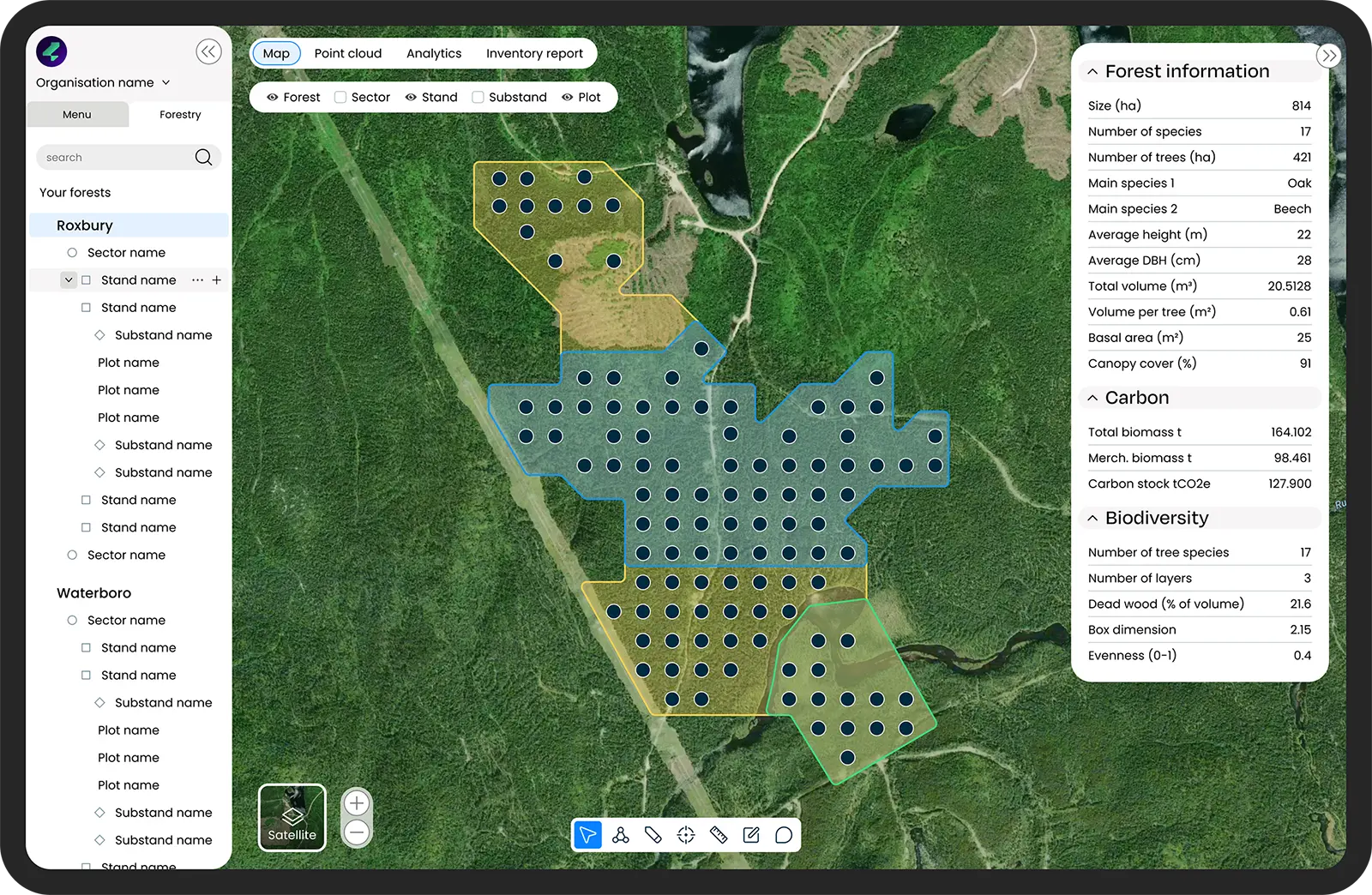
Map Services
Inventory network for the scanning points and manage the LiDAR data collected in the forest.
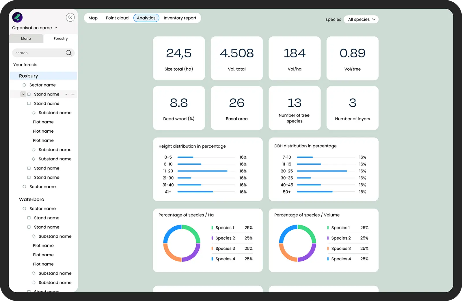
Analytics
Our analytics tool enables customised evaluation of the captured LiDAR data.
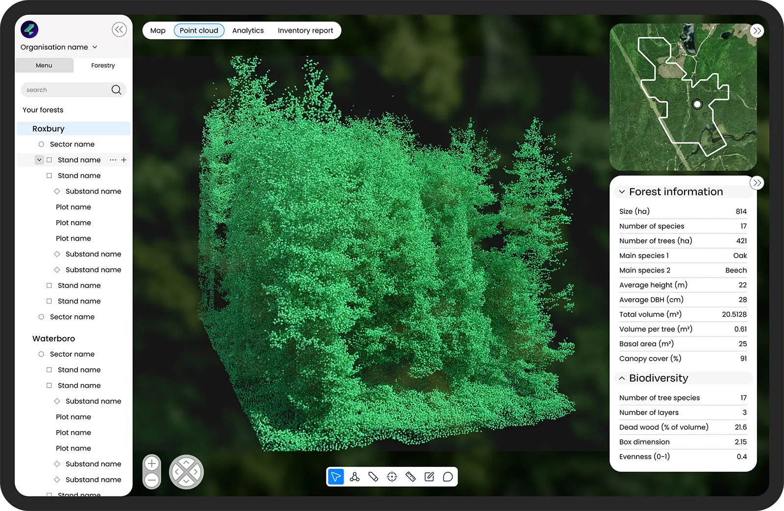
Point clouds
Visualising the point clouds! View all inventory plots from the comfort of your office and get an overview:
Data
integration
in
your
software
If you need to integrate our service with your existing forest software, we are ready to help you find a suitable solution.
Contact usReady to start?
Let's begin a forest project
or see a free demo!
© 2026 | All rights reserved