Whether you manage plantations or deliver field inventories, DFI Plantation gives every team the tools to work faster, smarter, and with full data visibility.
Key modules of the DFI Plantation platform
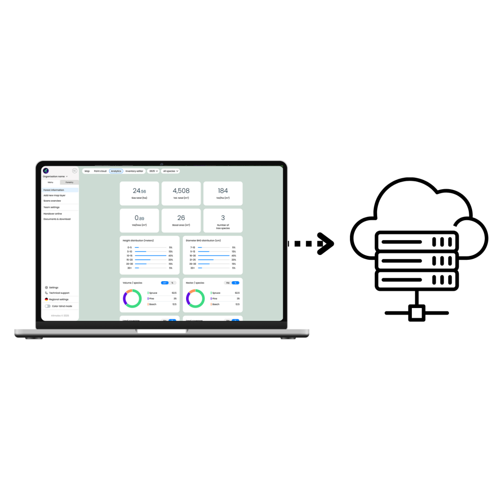
The DFI Plantation platform connects LiDAR-based field measurement with digital forest analytics, supporting reporting, planning, and long-term plantation management.
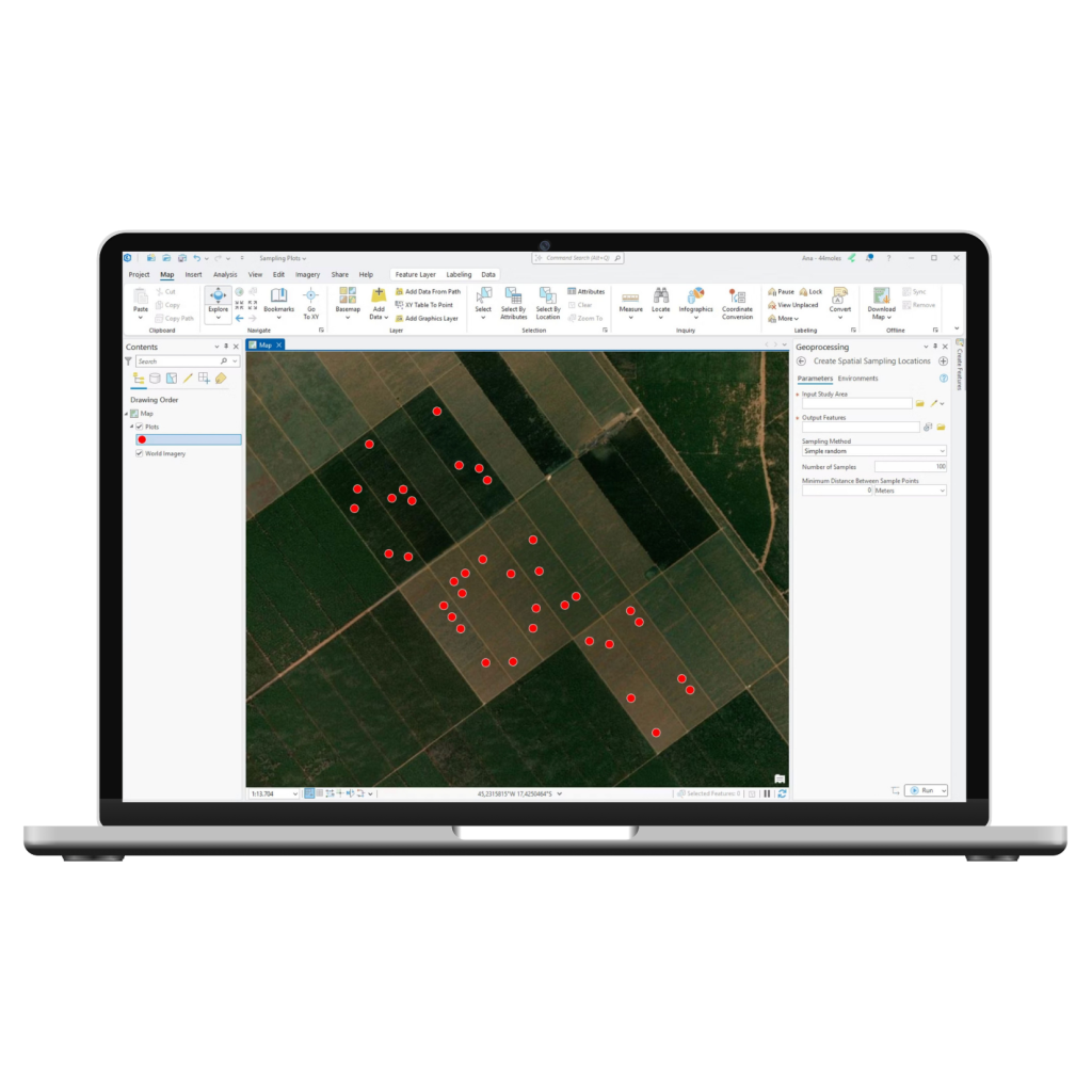
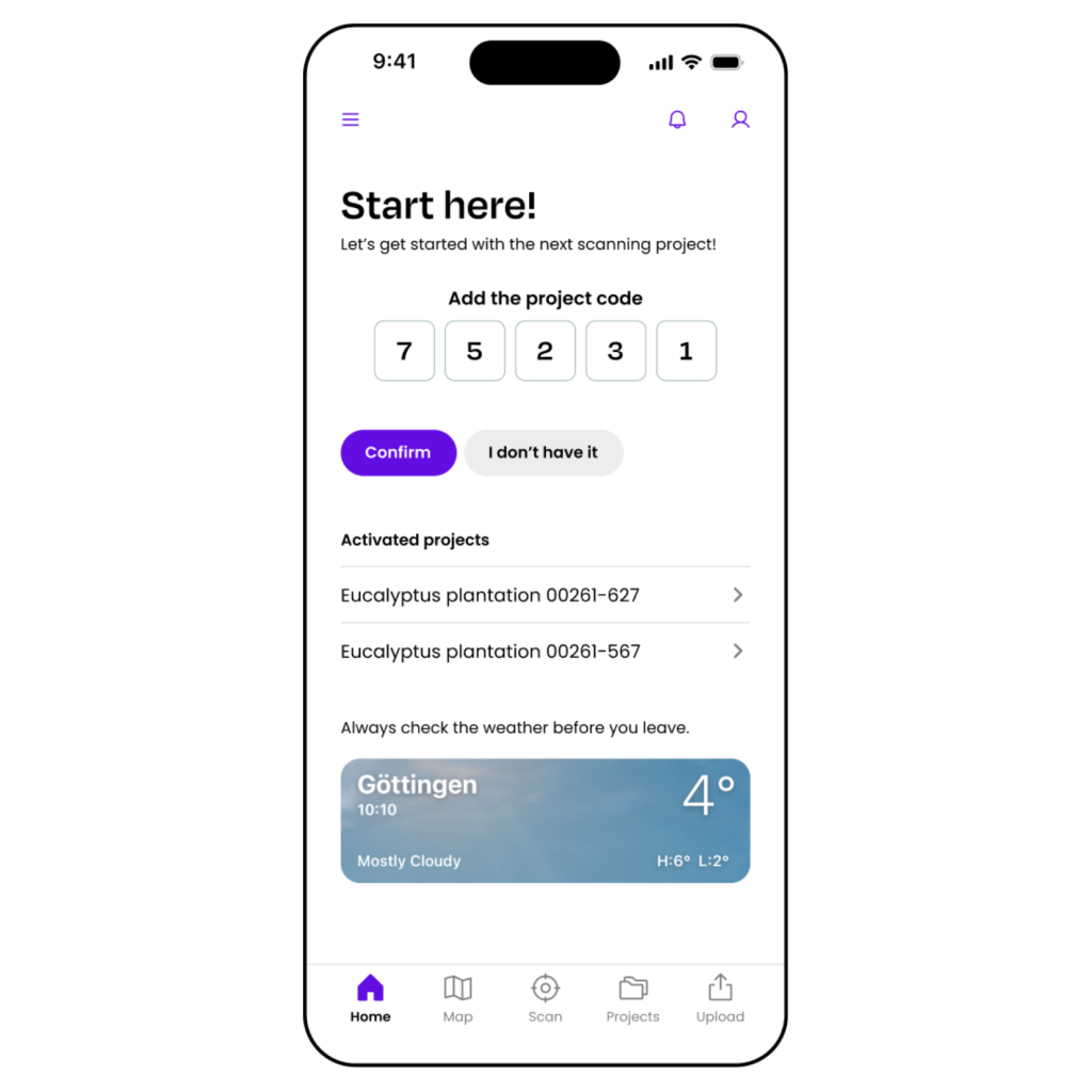
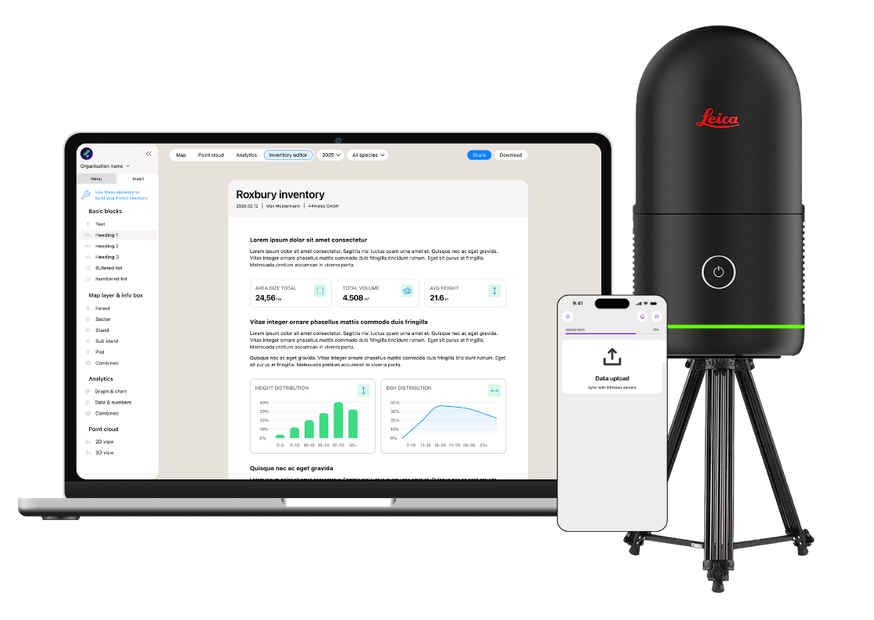
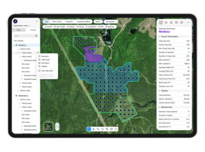
Plot management and TreeScan app
View all plots and track work progress in real time. Stay up to date as a landowner and monitor ongoing activities at any time.
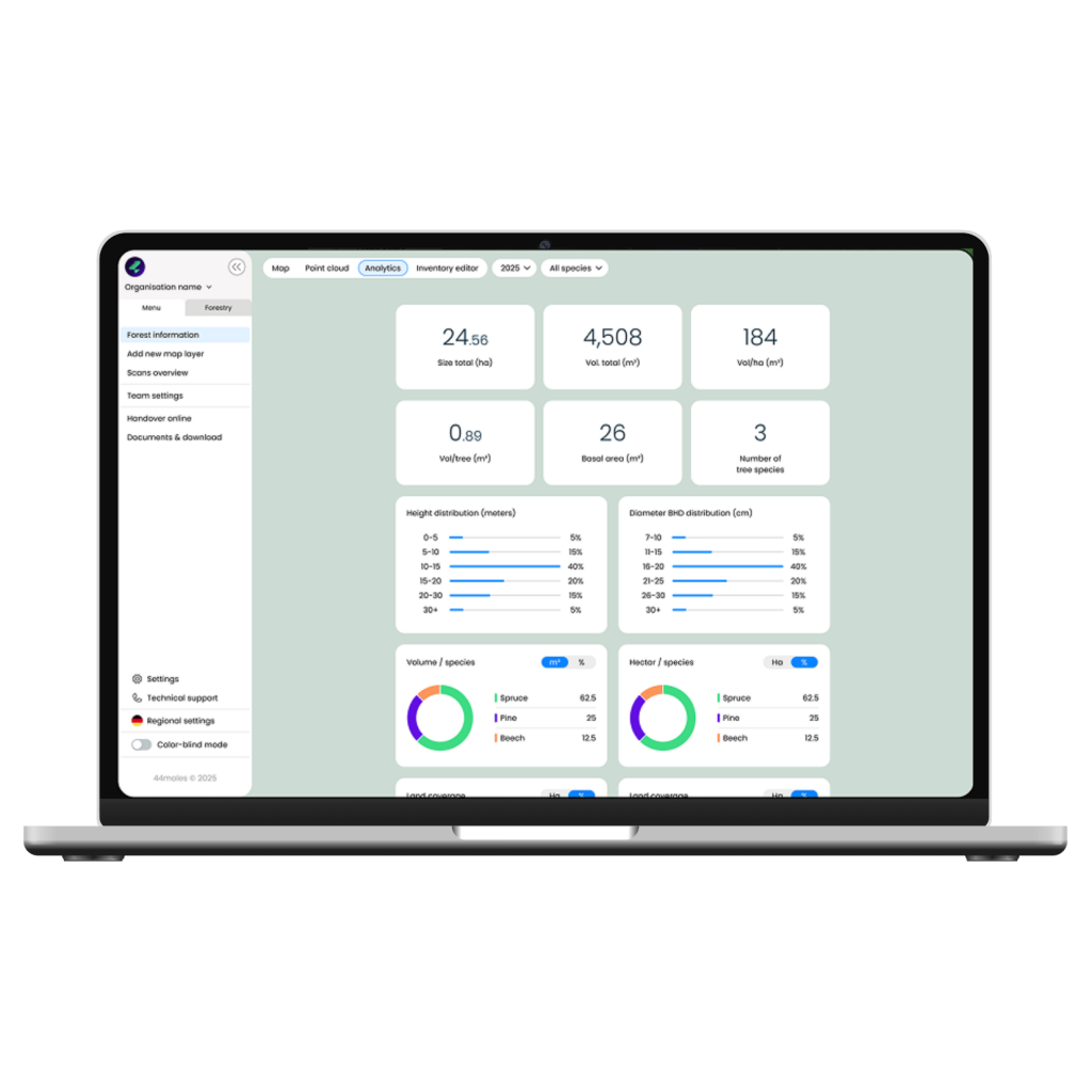
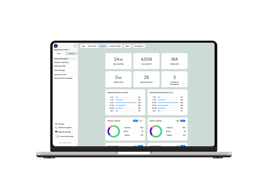
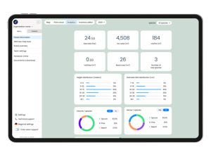
Analytics & Reporting
Standardized datasets and flexible parameter combinations support reporting, documentation, and long-term comparison.
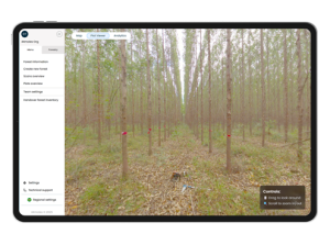
Plot viewer
360°degrees image of every plot as additional information to scanning data.